Difference between revisions of "MRP: Maps"
| Line 74: | Line 74: | ||
See [http://www.geog.cam.ac.uk/research/projects/occupations/hundredmapping/ Overview of Hundred mapping project for England and Wales] | See [http://www.geog.cam.ac.uk/research/projects/occupations/hundredmapping/ Overview of Hundred mapping project for England and Wales] | ||
---- | ---- | ||
| − | == | + | ==Wikipedia Media Commons: Hundreds by county== |
===Essex=== | ===Essex=== | ||
| Line 86: | Line 86: | ||
'''To be added''' | '''To be added''' | ||
| − | --- | + | ---- |
===Surrey=== | ===Surrey=== | ||
| Line 101: | Line 101: | ||
---- | ---- | ||
==Family Search Maps== | ==Family Search Maps== | ||
| − | === | + | ===Parishes within a named county=== |
| − | + | Uses 1851 county boundaries mapped as layers onto Google Map, displayed within a FamilySearch frame | |
| − | + | ||
| − | + | ||
| − | + | ||
| − | + | ||
| − | + | ||
| − | + | ||
| − | + | ||
| − | + | ||
| − | See [ | + | See [http://maps.familysearch.org/#lists List of parishes, and maps of parish boundaries] |
---- | ---- | ||
==External online maps== | ==External online maps== | ||
The following links provides maps of geographical relevance to the Oxenden and Dallison families: | The following links provides maps of geographical relevance to the Oxenden and Dallison families: | ||
| − | |||
===Kent=== | ===Kent=== | ||
Revision as of 15:59, February 27, 2012
Maps
Editorial history
15/08/11, CSG: Created page
Overview
This page lists a small number of maps which demonstrate some potential for GIS mapping of data contained within this wiki
Contents
Sample GIS mapping
To access the GIS maps below please ask the Wiki administrator for a separate authorisation URL
The following sample map links are provided to enable an exploration of data of different types - the geographical location of SVJS subscribers; the geographical location of Dallison family members and the family's friendship network; occupational data extracted from Prerogative Court of Canterbury wills for the 1640-99 period; and visual data from paintings and engravings for areas relevant to the Oxenden family.
The maps are best viewed in a separately opened window or windows.
Geographical location
MAP 4: Geographic location of investors in 1650s & 60s
MAP_North_Weald_Kent_C17th_Houses
Occupation
Wag(g)oner_Lorry_Man_Inventories_1640-99
Visual
English_&_Dutch_C17th-C19th_River_Paintings
Wikimedia Commons Mapping
County location maps
User:Nilfanion/Maps/Location maps
Ordinance Survey Open Data initiative
Ordinance Survey Open Space initiative
- OS OpenSpace APi enables OS maps to be displayed on non-commercial websites without charge
- Uses Javascript
Tufts digital library: County maps
Maps are displayed in a zoomable viewer enabling inspection of detail
Essex
Kent
To be added
Middlesex
See Middlesex
Surrey
To be added
Cambridge Group for the History of Population and Social Structure: Mapping Hundreds
See Overview of Hundred mapping project for England and Wales
Wikipedia Media Commons: Hundreds by county
Essex
To be added
Kent
To be added
Middlesex
To be added
Surrey
To be added
Roehampton: County hearth tax maps
Kent
To be added
Surrey
To be added
Family Search Maps
Parishes within a named county
Uses 1851 county boundaries mapped as layers onto Google Map, displayed within a FamilySearch frame
See List of parishes, and maps of parish boundaries
External online maps
The following links provides maps of geographical relevance to the Oxenden and Dallison families:
Kent
- Kent Archaeological Society map of West Kent parish boundaries
- Kent Archaeological Society map of East Kent parish boundaries
London
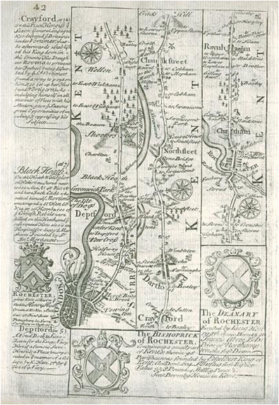
C17th & C18th Kent maps
[Route map with London, Deptford, Shooters Hill, Dartford, Chatham & Rainham] by Emanuel Bowen after the earlier survey by John Ogilby, and published by John Owen in Britannia Depicta ..., 1764. On the verso is part of a description of London. Copper engraved map. Size 12 x 18 cms plus margins. Ref E9984. Digital image by courtesy of antiqueprints.com
