Difference between revisions of "MRP: Maps"
| Line 1: | Line 1: | ||
| − | + | '''Maps''' | |
'''Editorial history''' | '''Editorial history''' | ||
Revision as of 19:11, January 2, 2012
Maps
Editorial history
15/08/11, CSG: Created page
THIS PAGE IS FOR DEMONSTRATION PURPOSES ONLY
The following sample map links are provided to enable an exploration of data of different types - the geographical location of SVJS subscribers; the geographical location of Dallison family members and the family's friendship network; occupational data extracted from Prerogative Court of Canterbury wills for the 1640-99 period; and visual data from paintings and engravings for areas relevant to the Oxenden family.
The maps are best viewed in a separately opened window or windows.
Access to the maps below requires a wiki to be sent a separate authorisation URL
Contents
Geographical location
MAP 4: Geographic location of investors in 1650s & 60s
MAP_North_Weald_Kent_C17th_Houses
Occupation
Wag(g)oner_Lorry_Man_Inventories_1640-99
Visual
English_&_Dutch_C17th-C19th_River_Paintings
External online maps
The following links provides maps of geographical relevance to the Oxenden and Dallison families:
Kent
- Kent Archaeological Society map of West Kent parish boundaries
- Kent Archaeological Society map of East Kent parish boundaries
London
C17th & C18th Kent maps
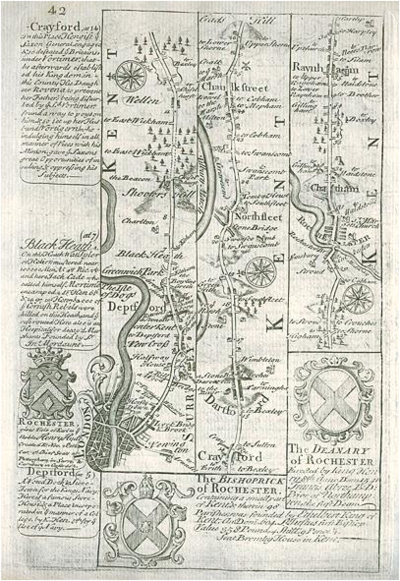
[Route map with London, Deptford, Shooters Hill, Dartford, Chatham & Rainham] by Emanuel Bowen after the earlier survey by John Ogilby, and published by John Owen in Britannia Depicta ..., 1764. On the verso is part of a description of London. Copper engraved map. Size 12 x 18 cms plus margins. Ref E9984. Digital image by courtesy of antiqueprints.com
